Traffic Analytics
Detection, ByteTrack tracking, line counting and bird's-eye speed estimation on a 4K highway video.
Detects, tracks, counts and measures the speed of vehicles on a highway video, and builds a heatmap of where they drive. The full pipeline (detection → multi-object tracking → line counting → perspective-corrected speed estimation) runs on a laptop CPU.
Example images not shown: the dataset licence (Roboflow
vehicles.mp4sample video, licence not verified) does not allow redistribution; see the dataset page.
Results
On the 4K sample highway video (538 frames, ~21 s):
| Metric | Value |
|---|---|
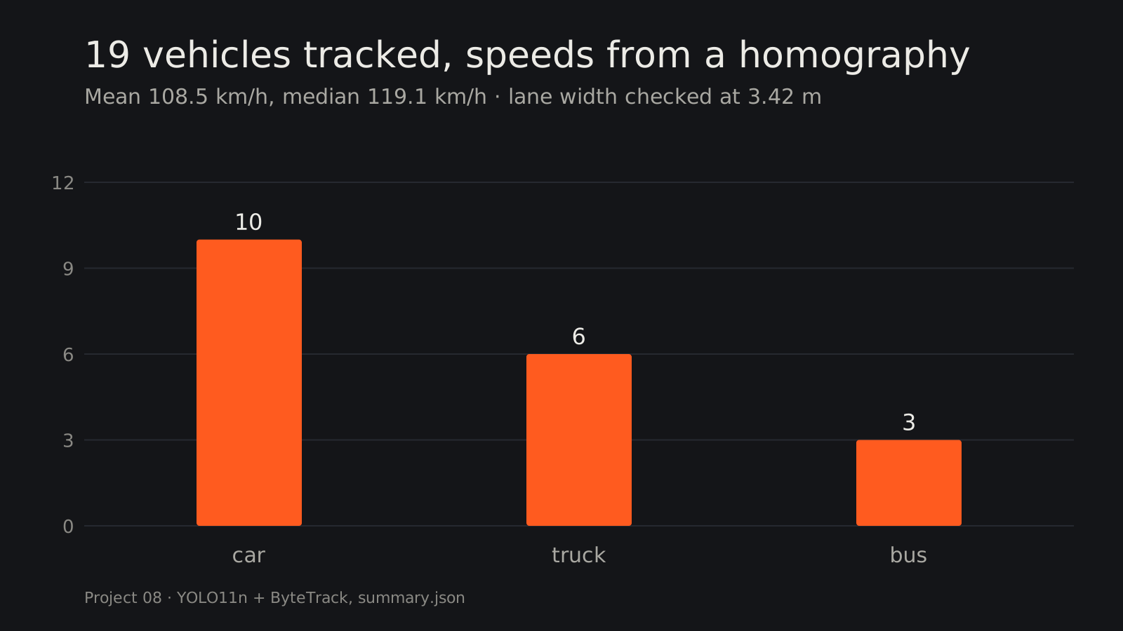
| Vehicles tracked (unique IDs) | 19 (10 cars, 6 trucks, 3 buses) |
| Counting line crossings | 2 in · 5 out |
| Median / mean speed | 119 / 109 km/h as calibrated; ≈ 132 / 120 km/h after the lane-marking check below |
| Processing speed | 3.4 FPS on CPU at 4K input (YOLO at 960 px) |
Left: tracked vehicles with IDs, speeds and the counting line. Right: accumulated traffic heatmap.
Calibration check: the road’s own ruler
Speeds depend on one assumption: that the road polygon is a 25 m × 250 m patch. There is no radar data for this
video, but the road carries two rulers of its own. calibration_check.py removes the
cars (median of 25 frames), warps the road to a bird’s-eye view with the same calibration, finds the white
markings and measures them in “calibrated meters”:
| Ruler | Measured with the current calibration | Typical European motorway | Implied correction |
|---|---|---|---|
| Lane width (4 lanes, both carriageways) | 3.42 m | 3.75 m | ×1.10 across |
| Dashed lane line: dash + gap period | 16.2 m (dashes 6.1–6.4 m) | 6 m + 12 m = 18 m | ×1.11 along |
Two independent measurements agree: the patch is about 10 % larger than assumed, so the speeds above are ~10 % low. Corrected, the median becomes ≈ 132 km/h (mean ≈ 120 km/h), right at the motorway’s 130 km/h limit. Caveat: the standards are typical values, not confirmed for this exact road; the measured dash length (~6 m) is consistent with the 6 m + 12 m pattern.
How it works
- Detection: YOLO11n (COCO-pretrained) finds cars, motorcycles, buses and trucks in each frame. Frames are resized to 960 px for the model, a trade-off between speed and small/far vehicles.
- Region of interest: only detections inside the road polygon are kept. That removes parked or distant vehicles that would be too small to measure.
- Tracking: ByteTrack links detections across frames into tracks with stable IDs. It also uses low-confidence detections to keep tracks alive through brief occlusions.
- Counting: a virtual line counts each track once when it crosses, in each direction.
- Speed estimation: a perspective transform (homography from 4 road points to a 25 m × 250 m rectangle) maps each vehicle’s bottom-center point from pixels to meters on the road. Speed = distance travelled along the road over the last second (km/h).
- Heatmap: vehicle positions accumulate into a heatmap of lane usage.
Why the perspective transform matters
In the image, a car near the camera moves many more pixels per second than one far away at the same speed. Mapping to a bird’s-eye view in meters makes speeds comparable anywhere on the road.
Data
- Video:
vehicles.mp4from Roboflow’s supervision sample assets (downloaded automatically on first run to../../cv-data/traffic/). - Model: YOLO11n COCO weights from Ultralytics (downloaded automatically, AGPL-3.0).
- Calibration: road polygon and real-world size (≈ 25 m × 250 m) for this camera view.
Run it
.venv\Scripts\activate            # shared environment, from the repo root
cd 08-traffic-analytics
python traffic.py                              # sample video
python traffic.py --video my_clip.mp4 --max-frames 300
The annotated video is saved to ../../cv-data/traffic/outputs/traffic_annotated.mp4. For your own
camera, change SOURCE (4 road corners in pixels), TARGET_W/H (their real size in meters) and LINE.
What I learned / what didn’t work
- Speed is only as good as the calibration. The 25 m × 250 m road size was an estimate; measuring the lane markings showed it was ~10 % off, which is a 10 % speed error. The speeds are still not validated against ground truth (no radar/GPS data for this video); the markings make them consistent, not measured.
- Median of frames is a free background model. Cars move, markings don’t: the per-pixel median of 25 frames spread over 21 s gives an empty road to measure.
- A code review found the road rectangle mapped 250 m to 249 units (speeds ~0.4 % low). Fixed in the code; the numbers above come from the run before the fix.
- Far vehicles are the weak point. At the top of the frame cars are a few pixels tall, so the road polygon starts below them on purpose. Detecting them would need a larger input size or a model fine-tuned on traffic footage.
- CPU throughput (3.4 FPS at 4K) is fine for offline analysis but not live video. Project 19 benchmarks the same detector with OpenVINO on this laptop’s iGPU and NPU.
sv.ByteTrackis deprecated in supervision 0.30 (removed in 0.31); pinsupervision<0.31or migrate to the new tracker API.
Next steps
- Fine-tune the detector on traffic data for small, far-away vehicles.
- Run on OpenVINO (iGPU) for real-time throughput.
- Per-lane counts and speed-limit violation flags.
Tech stack
Python · Ultralytics YOLO11 · supervision (ByteTrack, zones, annotators) · OpenCV (homography)